Filter: Categories of Wisconsin Historical Images
Filter: Subject of Landscape
Filter: County of Grant
Filter: Categories of Wisconsin Historical Images
Filter: Subject of Landscape
Filter: County of Grant
| Date: | 04 18 1965 |
|---|---|
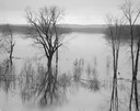
| Description: | Wisconsin River in flood, looking downstream. |
| Date: | 07 04 1965 |
|---|---|
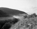
| Description: | Hills and fog at sunrise, looking out from the north side of the Wisconsin River. |
| Date: | 09 10 1961 |
|---|---|
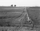
| Description: | Several fields containing wagon tracks along the side of a fence, in the vicinity of Highway P. |
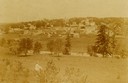
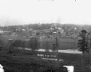
| Date: | 1899 |
|---|---|
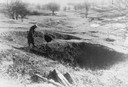
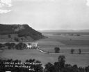
| Description: | View of Bloomington, with a man in the foreground looking over the vista. |
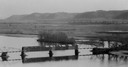
| Date: | 1933 |
|---|---|
| Description: | Elevated view of a covered railroad bridge over a calm body of water, with bluffs in the background. |
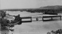
| Date: | |
|---|---|
| Description: | Elevated view of railroad bridge over the river. Part of the bridge is covered. Bluffs are in the background. |

| Date: | |
|---|---|
| Description: | Elevated view from bluff of a house in Cassville surrounded by bluffs, trees and farmland. Railroad tracks run between the crops and the trees, and the Mis... |
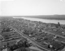
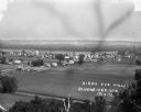
| Date: | 1900 |
|---|---|
| Description: | Aerial view of town. The Mississippi River and far shoreline is in the background. The Furnace Branch creek runs through the town in the foreground. |
| Date: | |
|---|---|
| Description: | View of the one-room schoolhouse, located 2 1/2 miles south of Dickeyville. |
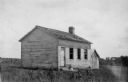
| Date: | 10 12 1947 |
|---|---|
| Description: | Aerial view of Cuba City Cannery. |
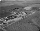
| Date: | |
|---|---|
| Description: | View from field of two horses grazing near a fence in the area outside the clapboard school building. There is a small outhouse on the far left. A hill wit... |
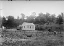
| Date: | 07 03 1965 |
|---|---|
| Description: | Landscape view of rolling croplands planted with corn. A dirt road is at the bottom of the hill, with trees beyond. |
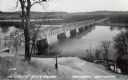
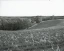
| Date: | |
|---|---|
| Description: | Photographic postcard from hill looking down at the bridge over the Wisconsin River. A gas station is visible on the right. Text below reads: "Wisconsin Ri... |
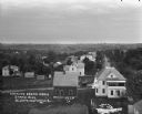
| Date: | |
|---|---|
| Description: | Bird's-eye view of Bloomington. In the open space, there are trees and a creek. In the developed area, there are stores, apartments, and barns. The buildin... |
| Date: | 1916 |
|---|---|
| Description: | Elevated view from the water tower. There is a laundry line in the backyard of the white house in the foreground. A car is driving down the road. In the di... |
| Date: | 1913 |
|---|---|
| Description: | Bird's-eye view of the village. Cropland and barns cover much of the landscape. |
| Date: | |
|---|---|
| Description: | A bird's-eye view of a farmland property with barns and farmhouse. |
| Date: | 1913 |
|---|---|
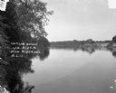
| Description: | A view across the river. Trees are along the left shoreline. |
| Date: | 1913 |
|---|---|
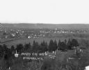
| Description: | View of town. There is a cemetery in the foreground. |
If you didn't find the material you searched for, our Library Reference Staff can help.
Call our reference desk at 608-264-6535 or email us at: