Filter: Categories of Wisconsin Historical Images
Filter: Subject of Harbors
Filter: Categories of Wisconsin Historical Images
Filter: Subject of Harbors
| Date: | |
|---|---|
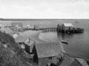
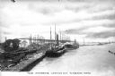
| Description: | Elevated view from hill of a harbor with docks and shacks along the shoreline. |
| Date: | |
|---|---|
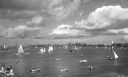
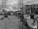
| Description: | A bay with sailboats and other small craft, and a view of the shoreline and town beyond. |
| Date: | |
|---|---|
| Description: | Elevated view of Pigeon Cove Harbor with fishing boats, Sandy Bay and Rockport coastline beyond. |
| Date: | |
|---|---|
| Description: | View looking down toward a wharf with lobster pots, and boats out in the harbor. |
| Date: | |
|---|---|
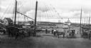
| Description: | A view toward a wharf with horse-drawn vehicles in the foreground, and a steamship in the distance. |
| Date: | |
|---|---|
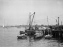
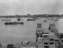
| Description: | Aerial view of a harbor with a wharf in the foreground, and buildings and boathouses along the shoreline. |
| Date: | |
|---|---|
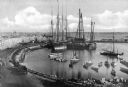
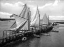
| Description: | Elevated view of a long, curving pier on the bay with large sailboats with sails out on the left side, and smaller boats on the right. |
| Date: | |
|---|---|
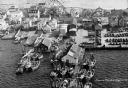
| Description: | A view of boats in harbor. People are standing on top of a boat in the right foreground. |
| Date: | |
|---|---|
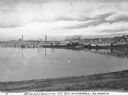
| Description: | View over shoreline toward steamboats moored out in a harbor with buildings lining the far shoreline. Caption reads: "Steamboats at St. Michael, Alaska." |
| Date: | 1910 |
|---|---|
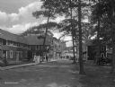
| Description: | Street side view of waterfront hotels and amusements on Milford harbor. |

| Date: | |
|---|---|
| Description: | Elevated view of village homes on the shores of the bay with docked fishing boats in the foreground. Caption reads, "Marblehead, Mass from Rockmere Point." |
| Date: | |
|---|---|
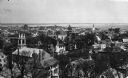
| Description: | Elevated view looking down on the town with the bay and opposite shoreline in distance. |

| Date: | |
|---|---|
| Description: | Hand-drawn map of the area at the time of Pilgrim landing, drawn by Charles Blaskowikz. Includes commemorative historical notes. |

| Date: | 1917 |
|---|---|
| Description: | World War I poster urging newly arrived immigrants to conserve food to aid the allied cause. People in ethnic costume being ushered into the United States ... |
| Date: | 1920 |
|---|---|
| Description: | A view of boats laden with ore docked at the harbor. Caption reads: "The Harbor -- Looking Out, Lorain, Ohio." |
| Date: | |
|---|---|
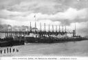
| Description: | A view of ships laden with ore unloading at Brown Hoists. Caption reads: "Unloading Ore at Brown Hoists, Lorain, Ohio." |

| Date: | 1915 |
|---|---|
| Description: | Boats unloading at Standard Oil Co.'s pier, with a horse, wagon, and a number of men handling lumber and other building materials. |
| Date: | |
|---|---|
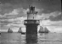
| Description: | View across water toward the Spring Point Lighthouse, established in 1897 and automated in 1934. There is a small boat near the base of the lighthouse, and... |
| Date: | |
|---|---|
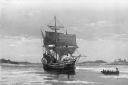
| Description: | "The 'Mayflower' in Plymouth Harbor, Mass." A copy of the painting by William F. Halsall from the collection of the Plymouth, Massachusetts colony. Paintin... |
If you didn't find the material you searched for, our Library Reference Staff can help.
Call our reference desk at 608-264-6535 or email us at: