 Filter: Categories of Wisconsin Historical Images
Filter: Subject of Fishes
Filter: Type of Map or Atlas
Filter: Categories of Wisconsin Historical Images
Filter: Subject of Fishes
Filter: Type of Map or Atlas

| Date: | 1632 |
|---|---|
| Description: | The Wisconsin portion of Champlain's 1632 map, augmented since the previous one, for navigation according to the true Meridien, by Sieur de Champlain. The ... |

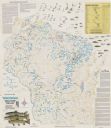
| Date: | 1941 |
|---|---|
| Description: | Hand-drawn, watercolor and ink, map of Lake Mendota. Locations and many small figures appear around the shore with explanations referring to Indian legends... |

| Date: | 1953 |
|---|---|
| Description: | A map of Lake Mendota that shows depths and the locations of various species of fish in lake. The maps also identifies a number of selected roads and stree... |
| Date: | 1991 |
|---|---|
| Description: | A map of Shawano Lake. Lake depths are shown by isolines. "Not intended for navigation." It includes a location map and a list of fish. |

| Date: | 1990 |
|---|---|
| Description: | This tourism brochure of Ashland County, Wisconsin, from the Ashland Area Chamber of Commerce includes a map of the county showing tourist destinations and... |

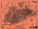
| Date: | 1930 |
|---|---|
| Description: | Original map made with watercolor and inkwash. Includes a legend of buildings, roads, natural features and other details of the lodge. Inset at bottom has ... |
| Date: | 1987 |
|---|---|
| Description: | This map shows creeks, lakes, ponds, and rivers. Also included are illustrations and a table of trout food, tips on trout fishing and notes on top trout st... |

| Date: | 1975 |
|---|---|
| Description: | This map provides an index of outdated quadrangle maps for the state. Communities, counties, rivers, and lakes are labeled including Lake Michigan and Lake... |

| Date: | 1946 |
|---|---|
| Description: | This bird's-eye-view map shows scenes of land use and farming superimposed on a map of the United States. Agricultural scenes of farming, livestock, and cr... |

| Date: | 1969 |
|---|---|
| Description: | This map shows businesses, resorts, roads, public boat landings, schools, cemeteries, and location of fish and game. An inset map reads: Continuation along... |

| Date: | 1958 |
|---|---|
| Description: | This map shows state public hunting and/or fishing grounds, national forests, state forests, county forests.The lower margin includes an index to these loc... |

| Date: | 1715 |
|---|---|
| Description: | One of Herman Moll's most famous maps, often referred to as The Codfish Map, it shows rivers and portages, cities, Indian villages, wind directions, routes... |

| Date: | 1746 |
|---|---|
| Description: | Map of North America from the southern portion of James Bay to Florida. It shows the colonies, cities, Native American land, and topological and geographic... |

| Date: | 1780 |
|---|---|
| Description: | Map of North and South America, showing the boundaries of colonial territories, cities, settlements, rivers, lakes, and Native American land. Particular em... |

| Date: | 1760 |
|---|---|
| Description: | Map of North America based upon the cartographic work of de L'Isle. It shows cities, regions, lakes, rivers, Native American land, mountains, islands, and ... |

| Date: | |
|---|---|
| Description: | Map showing the location of the Little Bohemia lodge and restaurant, with major routes from Chicago and eastern and central Wisconsin. |
If you didn't find the material you searched for, our Library Reference Staff can help.
Call our reference desk at 608-264-6535 or email us at: