 Filter: Categories of Wisconsin Historical Images
Filter: Subject of Battlefields
Filter: Type of Map or Atlas
Filter: Categories of Wisconsin Historical Images
Filter: Subject of Battlefields
Filter: Type of Map or Atlas
| Date: | 1876 |
|---|---|
| Description: | A map of the site of the Battle of Point Pleasant. |

| Date: | |
|---|---|
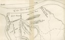
| Description: | Plan of the battle of the horse shoe bend on the East Pecatonica. |

| Date: | 1814 |
|---|---|
| Description: | Scale: about 43 miles to 1 in. Boundaries colored. |

| Date: | 1864 |
|---|---|
| Description: | (U.S. 39th Cong. 1stt Sess. Report of Chief engineer) The legend in the upper left corner contains a brief resume of each day's action while the map sho... |

| Date: | 1864 |
|---|---|
| Description: | This map of the Battle of Gettysburg indicates Union positions in red and Confederate positions in blue. Also shown are artillery positions, roads, railroa... |

| Date: | 1861 |
|---|---|
| Description: | This map was reproduced photographically and issued in Augusta, Ga., in the early days of the Civil War. It includes panels showing Virginia, Maryland, the... |

| Date: | 1861 |
|---|---|
| Description: | This map shows Manassas during the First Battle of Bull Run, in which the 2nd Wisconsin Infantry fought, and the Leesburg area, the site of the Battle of B... |

| Date: | 1876 |
|---|---|
| Description: | Detailed topographic map of the Gettysburg battlefield created thirteen years after the battle. This map shows day one of the battle. The map shows drainag... |

| Date: | 1862 |
|---|---|
| Description: | This map illustrates the official plan for the siege of Yorktown, Virginia, and indicates the headquarters of Generals McClellan, Porter, Woodbury, and Hei... |

| Date: | 1862 |
|---|---|
| Description: | This map shows the region of southeastern Virginia which served as the setting for the Peninsular Campaign of 1862. A few battle sites are marked by crosse... |

| Date: | 1862 |
|---|---|
| Description: | This map of the Battle of Shiloh shows relief by hachures, vegetation, drainage, houses, fields, fences, mills, and roads and is color coded to show the mo... |

| Date: | 1862 |
|---|---|
| Description: | This map of the Mississippi River between Island No. 8, northeast of New Madrid, Missouri, and Tiptonville, Tennessee, depicts the Confederate defenses at ... |

| Date: | 1862 |
|---|---|
| Description: | This map of the southeastern United States shows forts and battlefields, railroads, rivers, and cities and towns. Dates of admission and secession of the s... |

| Date: | 1862 |
|---|---|
| Description: | This pen and ink drawing of the First Battle of Bull Run, JuIy 21st, 1861, was made by Charles K. Dean, adjutant with the 2nd Wisconsin Infantry. The 2nd W... |

| Date: | 1863 |
|---|---|
| Description: | This map illustrates the position of Fort Hindman at Arkansas Post on the Arkansas River. Depicted are the positions of Confederate defenses as well ships ... |

| Date: | 1863 |
|---|---|
| Description: | This map is a hand-colored, pen and ink, drawing by Ole R. Dahl of Co. B, 15 Wisconsin Infantry shows the battlefield at Stones River, depicting roads, str... |

| Date: | 1863 |
|---|---|
| Description: | These detailed topographical maps of the Battle of Gettysburg show drainage, vegetation, roads, railroads, fences, houses with names of residents, and a de... |

| Date: | 1863 |
|---|---|
| Description: | These detailed topographical maps of the Battle of Gettysburg show drainage, vegetation, roads, railroads, fences, houses with names of residents, and a de... |

| Date: | 1863 |
|---|---|
| Description: | These detailed topographical maps of the Battle of Gettysburg show drainage, vegetation, roads, railroads, fences, houses with names of residents, and a de... |

| Date: | 1863 |
|---|---|
| Description: | This colored map of the Battle of Chattanooga depicts the positions of the Union and Confederate troops before the battle and on each day of the battle. Al... |
If you didn't find the material you searched for, our Library Reference Staff can help.
Call our reference desk at 608-264-6535 or email us at: