 Filter: Categories of Wisconsin Historical Images
Filter: Subject of Aquatic animals
Filter: Year of 1700-1799
Filter: Categories of Wisconsin Historical Images
Filter: Subject of Aquatic animals
Filter: Year of 1700-1799
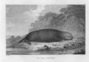
| Date: | 1784 |
|---|---|
| Description: | Plate 43. Scene from Cook's Third Expedition, 1776-1779, while in Alaska. |

| Date: | 1746 |
|---|---|
| Description: | This world map from the German mathematician, historian, and geographer Johann Matthias Hase shows the major cities, islands, and the major political divis... |

| Date: | 1740 |
|---|---|
| Description: | Map including the regions and cities of the northern half of North America. Native American land, rivers, lakes, mountains are labeled. Mountains, marshes,... |

| Date: | 1759 |
|---|---|
| Description: | Map of north eastern Canada and parts of New England, showing settlements, cities, portages, Native American land, mountains, lakes, and rivers. The unusua... |
If you didn't find the material you searched for, our Library Reference Staff can help.
Call our reference desk at 608-264-6535 or email us at: