 Filter: Categories of Wisconsin Historical Images
Filter: FULL_DATE of 1956
Filter: Type of Map or Atlas
Filter: Categories of Wisconsin Historical Images
Filter: FULL_DATE of 1956
Filter: Type of Map or Atlas

| Date: | 1956 |
|---|---|
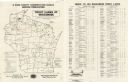
| Description: | A map depicting the for systems of land description in Wisconsin, which include metes and bounds, U.S. System of Rectangular Surveys, Latitude and longitud... |
| Date: | 1956 |
|---|---|
| Description: | A map that identifies the trout lakes in Wisconsin and their proximity to cities. Text on the page of the map highlights the conservation actions taken by ... |

| Date: | 1956 |
|---|---|
| Description: | This map shows the types of upland and lowland forest vegetation on Stockton Island, one of the Apostle Islands in Lake Superior. |

| Date: | 1956 |
|---|---|
| Description: | This 1956 map shows sections, cities and villages, roads, railroads, and lakes and streams in the Eagle River area. All or part of the towns of Plum Lake, ... |
| Date: | 1956 |
|---|---|
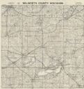
| Description: | Map shows townships and sections, landownership and acreages, roads, schools, churches, and cemeteries. |

| Date: | 1956 |
|---|---|
| Description: | Shows roads, railroads, highways, boundaries, and other public facilities and areas. Includes location map and legend. "Corrected for Feb. 1956." "Correcte... |

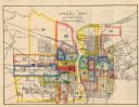
| Date: | 1956 |
|---|---|
| Description: | Map reads: "TAX EXEMPT LAND in the CITY OF MADISON". There is a legend of "Government Land" represented in stripes, "Religious and Fraternal Organization" ... |

| Date: | 1956 |
|---|---|
| Description: | Includes street index. Shows local streets, parks, highways, railroads, Fond du Lac River, and part of lake Winnebago. Also includes text on points of inte... |

| Date: | 1956 |
|---|---|
| Description: | Includes street index and index to points of interest. Shows land ownership by name, plat of town, local streets, schools, parks, highways, railroads, ward... |
| Date: | 1956 |
|---|---|
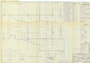
| Description: | Map of Richard I. Bong Air Force Base Military Reservation includes vicinity map, state index, segment index, and tract register of acquisition after 1 Jul... |

| Date: | 1956 |
|---|---|
| Description: | This map of Racine includes a street directory and index of public buildings. Streets, points of interest, Lake Michigan, and the Root River are labeled. A... |
| Date: | 1956 |
|---|---|
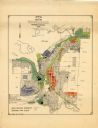
| Description: | This map of Rhinelander shows lots, 6 types of zoning in various colors; heavy industry, light industry, commercial, residence "A," residence "unrated," lo... |

| Date: | 1956 |
|---|---|
| Description: | This map is intended for tourists of La Crosse. The front of the map is text about attractions, activities, and accommodations in La Crosse. The back is th... |
| Date: | 1956 |
|---|---|
| Description: | This map shows streets and railroads and is oriented with north to the upper left. Wards have been outlined in yellow, red, blue, and green. The back of th... |

| Date: | 1956 |
|---|---|
| Description: | This maps shows voting precincts and polling places as well as wards. Streets and the Sheboygan River are labeled. The bottom right of the map features a l... |

| Date: | 1956 |
|---|---|
| Description: | Intended for tourists, this brochure features a map of Milwaukee's central business district as well as general information about parking, beaches and othe... |

| Date: | 1956 |
|---|---|
| Description: | This map shows Lake Wisconsin, roads, highways, parks, resort areas, camps, gardens, and Wisconsin State experimental game and fur farm. The back of the ma... |

| Date: | 1956 |
|---|---|
| Description: | This map shows local streets, roads, railroads, highways, parks, cemeteries, hospitals, the University of Wisconsin, Middleton, Maple Bluff, Shorewood Hill... |

| Date: | 1956 |
|---|---|
| Description: | This map shows reservation boundaries, U.S. township lines, highways, roads, rivers, and lakes. The lower left corner of the map includes a legend of "Conv... |

| Date: | 1956 |
|---|---|
| Description: | This map shows city, suburban, parochial and other types schools, with an explanation of symbols in the right margin. The original caption for the map read... |
If you didn't find the material you searched for, our Library Reference Staff can help.
Call our reference desk at 608-264-6535 or email us at: