 Filter: Categories of Wisconsin Historical Images
Filter: FULL_DATE of 1901
Filter: Type of Map or Atlas
Filter: Categories of Wisconsin Historical Images
Filter: FULL_DATE of 1901
Filter: Type of Map or Atlas

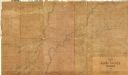
| Date: | 1901 |
|---|---|
| Description: | A hand-colored map of Iowa County, Wisconsin, shows townships and sections, towns, cities and villages, streams, landownership, roads, railroads and rural ... |

| Date: | 1901 |
|---|---|
| Description: | This 1901 map of Barron County, Wisconsin, shows the township and range grid, towns, cities and villages, roads, railroads, and lakes and streams. |

| Date: | 1901 |
|---|---|
| Description: | Map shows lakes, rivers, schools, saw mills, post offices, creameries, and churches. Includes significant manuscript annotations showing township divisions... |
| Date: | 1901 |
|---|---|
| Description: | Shows townships and sections, landownership and acreages, and rural buildings in what is now known as Rusk County. |

| Date: | 1901 |
|---|---|
| Description: | Map shows townships, schools, creameries, post offices, and roads. The left side of the map features a legend with symbols for points of interest. |

| Date: | 1901 |
|---|---|
| Description: | This map shows streets, industrial buildings, a portion of Lake Superior and other lakes, bays, and rivers in portions of Duluth and Superior. Relief is sh... |

| Date: | 1901 |
|---|---|
| Description: | This map shows public schools, engine houses, railroads, street railways, city wards, parks, block numbers, and Lake Michigan. Also included are indexes, t... |

| Date: | 1901 |
|---|---|
| Description: | This map shows city wards, block numbers, parks, cemeteries, roads, railroads, Lake Michigan, and selected buildings. Also included are indexes "Milwaukee ... |

| Date: | 1901 |
|---|---|
| Description: | This map shows landownership and acreages, townships and sections, and selected buildings. |

| Date: | 1901 |
|---|---|
| Description: | A Sanborn map of Tomahawk featuring the Bay Mill Company's lumber yard. |

| Date: | 1901 |
|---|---|
| Description: | A plat map of Marathon county, 28 township, north range, 7 east. |

| Date: | 1901 |
|---|---|
| Description: | A plat map of Marathon county, township 28, north range, 8 east. |

| Date: | 1901 |
|---|---|
| Description: | A plat map of Marathon county, township 29, north range, 6 east. |

| Date: | 1901 |
|---|---|
| Description: | A plat map of Marathon county, township 29, north range, 7 east. |

| Date: | 1901 |
|---|---|
| Description: | A plat map of Marathon county, township 29, north range, 8 east. |

| Date: | 1901 |
|---|---|
| Description: | Plat map showing land ownership of Township 21N Range 3W in Jackson County for 1901. Scale is 2 inches to 1 mile. |
If you didn't find the material you searched for, our Library Reference Staff can help.
Call our reference desk at 608-264-6535 or email us at: