Filter: Categories of Wisconsin Historical Images
Filter: FULL_DATE of 1864
Filter: Subject of intellectual life
Filter: Categories of Wisconsin Historical Images
Filter: FULL_DATE of 1864
Filter: Subject of intellectual life
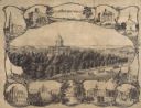
| Date: | 1864 |
|---|---|
| Description: | Bird's-eye view of Madison, with 12 vignettes and in the center is "The Capitol of Wisconsin View from the Capitol House". The buildings on the top are, fr... |
| Date: | 1864 |
|---|---|
| Description: | Carte-de-visite portrait of Jean Louis Rodolphe Agassiz (1807-1873), Swiss-born American zoologist, geologist and glaciologist. Founded the Museum of Compa... |
| Date: | 1864 |
|---|---|
| Description: | Carte-de-visite portrait of Edwin C. Bolles (1836-1920), professor of English and American History at Tufts. He is best known for amassing a vast archive o... |
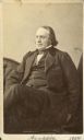
| Date: | 1864 |
|---|---|
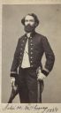
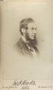
| Description: | Carte-de-visite portrait of Professor Joseph H. McChesney, a geologist and paleontologist associated with the Illinois State Geological Survey. Shown here ... |
| Date: | 1864 |
|---|---|
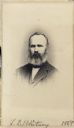
| Description: | Carte-de-visite portrait of Josiah D. Whitney (1819-1896), professor of Geology at Harvard University (1865-96), and chief of the Californa Geological Surv... |
| Date: | 1864 |
|---|---|
| Description: | Vignetted carte-de-visite portrait of Leo Lesquereux, American paleobotanist. Also worked as assistant to L. Aggasiz. |
| Date: | 1864 |
|---|---|
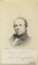
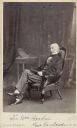
| Description: | Full-length carte-de-visite portrait of Asa Gray (1810-1888), American botanist. His most popular botanical publication, "Gray's Manual," remains a standar... |
| Date: | 1864 |
|---|---|
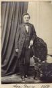
| Description: | Carte-de-visite portrait of Joseph D. Hooker (1817-1911), English botanist, plant collector and traveller. Son of Sir William Hooker. A close friend of C... |
| Date: | 1864 |
|---|---|
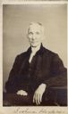
| Description: | Carte-de-visite portrait of Sir William Jackson Hooker (1785-1865), English botanist. Preceded his son, Joseph Dalton Hooker, as director of Kew Gardens. ... |
| Date: | 1864 |
|---|---|
| Description: | Carte-de-visite portrait of Josiah Hoopes (b. 1832, death date unknown), American botanist. In 1853, he established a tree nursery in West Chester, which i... |
| Date: | 1864 |
|---|---|
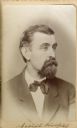
| Description: | Carte-de-visite portrait of Joshua Hoopes (1788-1874), American Botanist. An infant at the time of the Wyoming Indian massacre, his mother strapped him on ... |
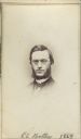
| Date: | 1864 |
|---|---|
| Description: | Vignetted carte-de-visite portrait of Daniel C. Eaton (1834-1895), American Botanist. In 1864 (the year of this photograph), Eaton became a professor of bo... |
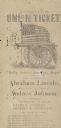
| Date: | 1864 |
|---|---|
| Description: | An Unconditional Union ticket printed in Indiana in 1864 in support of the candidacy of Abraham Lincoln and Andrew Johnson. The support for Lincoln's prose... |
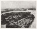
| Date: | 1864 |
|---|---|
| Description: | Aerial view, probably from a lithograph, of the prison for Confederate soldiers at Rock Island. |
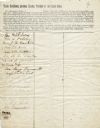
| Date: | 1864 |
|---|---|
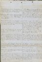
| Description: | Petition to President Abraham Lincoln for the establishment of soldiers homes and hospitals in Wisconsin. The petition is signed by 18 women. |
| Date: | 1864 |
|---|---|
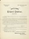
| Description: | Information about the Toechter Institut in Milwaukee. |
| Date: | 1864 |
|---|---|
| Description: | This document, sometimes cited as the “Statement made by the Indians, a bilingual petition of the Chippewas of Lake Superior, 1864,” was carried by an Ojib... |

| Date: | 1864 |
|---|---|
| Description: | This map is pen and watercolor on paper and shows a profile and geological sections of the Blue Mounds, Hollow Run, Bogies Hollow Run, Bear Creek, East Bre... |

| Date: | 1864 |
|---|---|
| Description: | This map is pen and watercolor on paper and shows a profile and geological sections of the East Blue Mound Break, Blue Mound Creek, Black Earth River, and ... |
If you didn't find the material you searched for, our Library Reference Staff can help.
Call our reference desk at 608-264-6535 or email us at: