 Filter: Categories of Wisconsin Historical Images
Filter: County of Jackson
Filter: Type of Map or Atlas
Filter: Categories of Wisconsin Historical Images
Filter: County of Jackson
Filter: Type of Map or Atlas

| Date: | 1875 |
|---|---|
| Description: | Bird's-eye map of Black River Falls, looking southwest. |

| Date: | 10 1884 |
|---|---|
| Description: | Sanborn insurance map of Black River Falls covering the area bordered by the Black River on the East, 3rd Street on the West, Johnson Street on the North, ... |

| Date: | 1883 |
|---|---|
| Description: | This birdseye view map reads: ""MERRILLAN JACKSON COUNTY, WISCONSIN. LOOKING FROM POSITION NORTH EAST ON THE TOWN." At the bottom are points to interest th... |

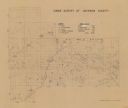
| Date: | 1879 |
|---|---|
| Description: | A map of Jackson County, Wisconsin, shows the township and section survey, landownership, towns, villages, buildings, roads, railroads, county land, and st... |

| Date: | 07 1868 |
|---|---|
| Description: | A hand-drawn map of a portion of Jackson County, Wisconsin between Township No. 21 north, range number 4 West and township no. 21 north, range no. 3 west, ... |

| Date: | 1935 |
|---|---|
| Description: | Two hand-colored maps of the area comprising the town of Millston (Plats of Townships 20 and 21 north, range 2 west), Jackson County, Wisconsin, showing 40... |

| Date: | 12 25 1942 |
|---|---|
| Description: | This hand-drawn map shows the highways and features in the Rock Lake-Lake Mills area in the towns of Aztalan and Lake Mills, Jefferson County, Wisconsin. T... |

| Date: | 1908 |
|---|---|
| Description: | Shows townships and sections, roads, and railroads. Includes list of towns, villages, and cities with organization dates. |
| Date: | 1939 |
|---|---|
| Description: | Shows location of deer, partridge, quail, prairie chicken, and pheasants. Includes game count table and significant manuscript annotations. Dated "3-25-39.... |

| Date: | 1976 |
|---|---|
| Description: | Panel title. Shows railroads, roads, highways, boundaries, dams, public hunting and fishing grounds, cemeteries, forest ranger stations, plant life, and s... |

| Date: | 1901 |
|---|---|
| Description: | Plat map showing land ownership of Township 21N Range 3W in Jackson County for 1901. Scale is 2 inches to 1 mile. |
If you didn't find the material you searched for, our Library Reference Staff can help.
Call our reference desk at 608-264-6535 or email us at: