 Filter: Categories of Wisconsin Historical Images
Filter: County of Crawford
Filter: Type of Map or Atlas
Filter: Categories of Wisconsin Historical Images
Filter: County of Crawford
Filter: Type of Map or Atlas

| Date: | 1870 |
|---|---|
| Description: | During the War of 1812, the only battle fought in Wisconsin was in Prairie du Chien, in 1814. Made fifty-six years later, this birds eye drawing depicts th... |

| Date: | 1820 |
|---|---|
| Description: | A manuscript map of Prairie du Chien. |

| Date: | 1821 |
|---|---|
| Description: | A topographical view of the site of Fort Crawford. |

| Date: | 1829 |
|---|---|
| Description: | Photoprint of Crawford County lead district map. |

| Date: | 1828 |
|---|---|
| Description: | Plat of the Private Claims at Prairie Du Chien. |

| Date: | 1878 |
|---|---|
| Description: | Illustrated map of Crawford County. On the bottom right is an inset of a group of people near a train on a railroad track. |

| Date: | 1820 |
|---|---|
| Description: | This map displays the plan for claiming various settlement zones in the Prairie des Chiens area in 1820. It shows Fort Crawford and 87 confirmed and unconf... |

| Date: | 1830 |
|---|---|
| Description: | This early 19th century manuscript map of Prairie du Chien, Wisconsin, shows sections, landownership and acreages, roads, and ferries in the towns of Bridg... |

| Date: | |
|---|---|
| Description: | This 19th century manuscript map shows the township and range systems, sections, and acreages along the Mississippi River in the towns of Freeman and Senec... |

| Date: | |
|---|---|
| Description: | This 19th century manuscript map shows land claims near the confluence of the Wisconsin River with the Mississippi River in the Town of Bridgeport, Crawfor... |

| Date: | 1878 |
|---|---|
| Description: | This map of Crawford County, Wisconsin, shows the township and range grid, sections, towns, cities and villages, land ownership and acreages, roads, railro... |
| Date: | |
|---|---|
| Description: | These 19th-century manuscript maps show the survey of much of Crawford County, Wisconsin. Plats for the towns of Prairie du Chien and Bridgeport and for th... |

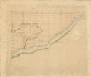
| Date: | 01 09 1849 |
|---|---|
| Description: | Shows county line boundaries, rivers, and falls. Includes explanation of township and county divisions. Pen and pencil on paper. Title supplied by cataloge... |

| Date: | 1911 |
|---|---|
| Description: | Blue line print. Shows post offices, houses, schools, churches, roads, routes, rivers, and railroads. Includes explanation of symbols. "H.G.M. October 12,... |

| Date: | 1890 |
|---|---|
| Description: | This is a plat map of "Wauzeeka" drawn in pencil. The map shows numbered lots, labeled streets, the Kickapoo River, and railroads. The map reads: "Laid out... |

| Date: | 1882 |
|---|---|
| Description: | This map is ink on cardboard and shows the location of military forts over the course of years. Also shown are points of interest, streets, the Mississippi... |

| Date: | 1864 |
|---|---|
| Description: | This map is ink, pencil, and color on paper and shows numbered lots and labeled streets. The bottom margin of the map reads: "Recorded in the Registry of d... |

| Date: | 01 15 1929 |
|---|---|
| Description: | Intended for tourists, this brochure, titled: "Winneshiek World’s Famous Wild Life Refuge Historic Fort Crawford and Picturesque Prairie du Chien," feature... |

| Date: | 1950 |
|---|---|
| Description: | Intended for tourists, this brochure features two maps with tourists sites along the Mississippi River. One map shows roads and populated places along the ... |
If you didn't find the material you searched for, our Library Reference Staff can help.
Call our reference desk at 608-264-6535 or email us at:
