Filter: Categories of Wisconsin Historical Images
Filter: Creator Name of Brown, Charles N.
Filter: Categories of Wisconsin Historical Images
Filter: Creator Name of Brown, Charles N.
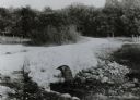
| Date: | 1900 |
|---|---|
| Description: | Wetland, grassy pasture, ring fence are part of the College of Agriculture Farm on the University of Wisconsin Madison campus. |
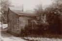
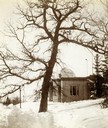
| Date: | 1899 |
|---|---|
| Description: | View of home atop of Observatory Hill on the University of Wisconsin-Madison campus. |
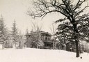
| Date: | 1900 |
|---|---|
| Description: | Winter scene of Observatory Hill office building on the University of Wisconsin Madison campus, with building and trees topped with snow. |
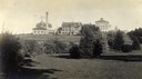
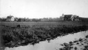
| Date: | 1903 |
|---|---|
| Description: | View towards the College of Agriculture on the University of Wisconsin campus, with Bascom Hall in the distance on a hill. |
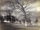
| Date: | 1896 |
|---|---|
| Description: | View of Washburn Observatory in the winter with snow. |

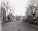
| Date: | 03 15 1896 |
|---|---|
| Description: | Winter view down Capitol Avenue, possibly in Maple Bluff. |
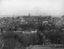
| Date: | 11 24 1898 |
|---|---|
| Description: | View from Bascom Hill toward the Wisconsin State Capitol showing the Wisconsin Historical Society under construction. |

| Date: | 1907 |
|---|---|
| Description: | The Yahara River Parkway, with the old Lapham School at 1436 East Dayton Street at North Thornton visible on the righthand side. |

| Date: | 1906 |
|---|---|
| Description: | View from shoreline looking over a pathway towards the Steensland Bridge and Yahara River Parkway at East Washington Avenue. |
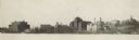
| Date: | 1900 |
|---|---|
| Description: | View across Lake Mendota towards the lower campus buildings at the University of Wisconsin-Madison. |

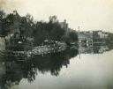
| Date: | 1906 |
|---|---|
| Description: | Shacks at the foot of North Main Street along Lake Monona near what later became Brittingham Park. |

| Date: | 1906 |
|---|---|
| Description: | Area at the foot of West Main Street, which is now Brittingham Park. Weatherworn buildings are on the right. |

| Date: | 1909 |
|---|---|
| Description: | View from Sunset Point in Owen Park, which is now a part of Hoyt Park. Lake Mendota is in the distance. |
| Date: | 1898 |
|---|---|
| Description: | View across water towards the Lake Mendota shoreline from the foot of Frances Street. |
| Date: | 05 12 1896 |
|---|---|
| Description: | View down Langdon Street looking west toward Science Hall. |
If you didn't find the material you searched for, our Library Reference Staff can help.
Call our reference desk at 608-264-6535 or email us at: