 Filter: Categories of Wisconsin Historical Images
Filter: COLLECTION_NAME of Library Collection
Filter: Type of Map or Atlas
Filter: Categories of Wisconsin Historical Images
Filter: COLLECTION_NAME of Library Collection
Filter: Type of Map or Atlas
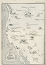
| Date: | 06 1930 |
|---|---|
| Description: | A map of the western states showing "public playlands," mostly national parks. |
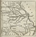
| Date: | |
|---|---|
| Description: | Map of Missouri with major cities, rivers, and railroads marked. |
| Date: | 1862 |
|---|---|
| Description: | Diagram and seating chart for the Wisconsin State Assembly. |

| Date: | 1887 |
|---|---|
| Description: | Map of the Fox and Wisconsin Rivers to accompany Reuben Gold Thwaites' Historic Waterways. |

| Date: | 1850 |
|---|---|
| Description: | Map showing Indian mounds and graves as well as ground cover types at Township 8, Range 22. There is an inset diagram of an effigy mound labeled "The Cross... |

| Date: | |
|---|---|
| Description: | Map showing Indian mounds in Milwaukee's Second Ward from a sketch made by Increase Lapham in 1836. Streets shown on the map include 6th Street, 5th Street... |

| Date: | 1828 |
|---|---|
| Description: | Map of the Louisville and Portland Canal on the Ohio River. The map shows Louisville, Shippingsport, Clarksville, Jeffersonville, Gravel Island, Corn Islan... |

| Date: | 1900 |
|---|---|
| Description: | A hand-drawn map of the battlefield of the Battle of Chickamauga. |

| Date: | 1866 |
|---|---|
| Description: | Diagram and seating chart for the Wisconsin State Senate in the second State Capitol Building which burned down in 1904. |

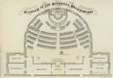
| Date: | 1866 |
|---|---|
| Description: | Diagram and seating chart for the Wisconsin State Assembly in the second State Capitol Building which burned down in 1904.. |
If you didn't find the material you searched for, our Library Reference Staff can help.
Call our reference desk at 608-264-6535 or email us at:
